Showing posts with label sightseeing. Show all posts

Friday, May 18, 2012

An Unexpected Bit of Treasure

The road from Reno, Nevada to Las Vegas, Nevada is long, mostly straight and occasionally hilly.  For Denny and I, it's way too far to drive in one trip so I chose the small town of Tonopah as our kinda halfway stopping off point.  The local chain hotel provides a few slot machines and about 20 full hook up RV sites in the rear at a reasonable cost, although the cost was mostly to our sleep thanks to a cadre of construction folks who fired up their trucks at 4:45 AM every morning.  

Denny had done something to his ankle (swearing I had kicked him during the night) so my planned day of exploring had to be put off for a day.  The next day was much warmer but since, as they say, it was a dry heat it was a nice day for wandering the grounds of the Tonopah Mining Park.  Imagine if you will land populated mainly by Native Americans who called the area Tonopah which roughly translates to "greasewood water", greasewood being a type of bush native to the area.  Local lore says silver ore was discovered when farmer Jim Butler was trying to round up a burro that had run off and grabbed a rock to throw at the critter.  Curious due to the weight of the rock, Jim had it assayed and discovered it was silver ore.  His wife Belle convinced Jim to stake out some claims which he later rented out and thus the area of Tonopah ended up being the "Queen of the Silver Claims" in the early 1900s. That, of course, is the extremely abbreviated version of the story.

A view of the town of Tonopah with the Mizpah Hotel dominating the center of the photograph.  Built in 1907 it is currently undergoing renovation by the new owners.

The Tonopah Mining Park is a huge complex of parts of four of the original mines owned by the Butlers.  Much of the equipment used during the 1900s still remains where it was left and you can go into many of the buildings on the grounds.

An ore crusher and other equipment.
The Grizzly is the building where silver ore was taken to be hand sorted into high and low grade ore; the good ore went into bins and the bad ore was tossed outside onto piles.
The remains of an ore wagon.  Before a special railway spur was built in Tonopah the ore was carried out on wagons pulled by teams of horses.


The visitor center houses a small museum, a gift shop and a small theater where you are shown a 15 minute video of the history of the mines and the original discovery of silver ore by Jim Butler.  There is a very nice display of the various minerals found in the area and in the state of Nevada and the volunteers at the visitor center are most helpful in explaining the various areas of the museum and will try to answer any questions you have.  The entry fee is $5 for adults, $4 for seniors, free to veterans.  If you are staying overnight and have your room/campground receipt the staff will knock a dollar off the fee.

You will find the grounds much as they were left when the silver boom was over and the miners all left.  While you can't crawl down into the mine shafts, you can see down into the stopes (hand dug trenches.)  This particular stope is at the end of the reconstructed burro tunnel and is 500 feet long.

The view from the area of the Mizpah mine.
The Silver Top mine hoist,used to lift buckets of ore from the mine.
One of the original miners' cabins near the Silver Top mine with the Silver Top hoist in the background.
Looking down at the Mizpah Mine Hoist and Hoisthouse.
Apparently with the dry conditions here one didn't worry about careful storage of explosives; this is the powder magazine where the dynamite and blasting caps were kept.
The park has several well marked trails leading to the Desert Queen mine, the Silver Top mine, the Mizpah mine, the North Star mine and the Montana-Tonopah mine as well as other areas of interest such as mill ruins.  The staff will warn you, however, that the park sits at 6200 feet elevation and many of the paths lead uphill.  You not only need to carry water with you, but you need to be aware of your physical limitations or of how the elevation might affect you.
There are picnic tables at the visitor center as well as some near the Mizpah hoist house.  You have a great 360 degree view of the city and the surrounding area while you sit and ponder the amazing tenacity of the miners who worked so hard to bring millions of dollars of silver and gold out of these hills.
And another unexpected gem for our travels.

Sunday, April 22, 2012

An Awesome Drive

One of the best things about full time rv travel is that by being on the road 12 months of the year you can arrive at busy tourist areas during the non-peak seasons.  Sometimes that means that you have to deal with bad weather or non-optimal conditions.  However on Thursday morning the overcast skies cleared around our campground so we decided to make the drive over to the Monterey and Pebble Beach area to follow the 17 Mile Drive and do some sightseeing.

Unfortunately Bl*gger refuses to cooperate when it comes to uploading photographs in the order I want them to upload unless I do them one at a time and I'm too impatient for that, so you have a mishmash here.  I'll simply add captions and let the photographs speak for themselves for the most part.

Monterey is a pretty little town but like many pretty little older towns that are now tourist areas the streets are narrow, the parking is limited and our big ol' truck is hard to maneuver so we didn't stop.  This display of carvings was right next to the intersection where we were stopped at a traffic signal.
The idea of Cannery Row appealed to me due to the John Steinbeck novel but of course now it's street after street of shops and the line to the Monterey Aquarium was all the way down the block so we kept driving.


Denny and I found a place to park Black Beauty along Lover's Point.  We offered a man who was out on the point a dollar to take our picture (kidding) and he said another man down the way had offered him five dollars so we compromised on two dollars and fifty cents.  We enjoy it when people play along with our silliness.  And of course we took a picture of him and his lady friends in return.
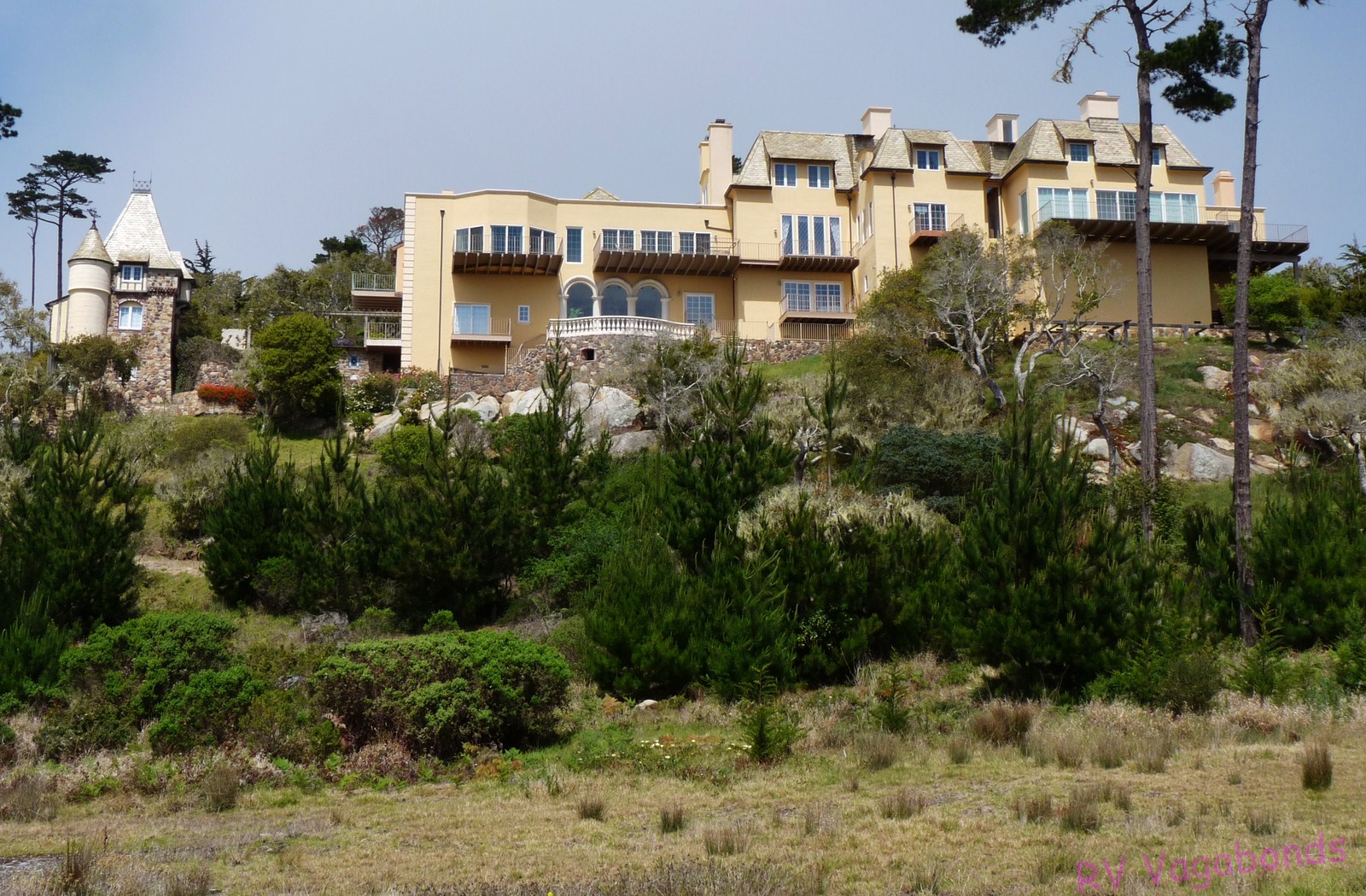
Out of order, this is the Chatillon Sur Mer, one of the hundreds of gorgeous residences (cottages a la the Hamptons?) along the 17 Mile Drive of Pebble Beach.  Since a standard four bedroom/3 bath one story home in Hollister, California which is 50 miles inland is selling for $549,000 how much do you suppose this baby would cost?
The view from Lover's Point in Pacific Grove, California.
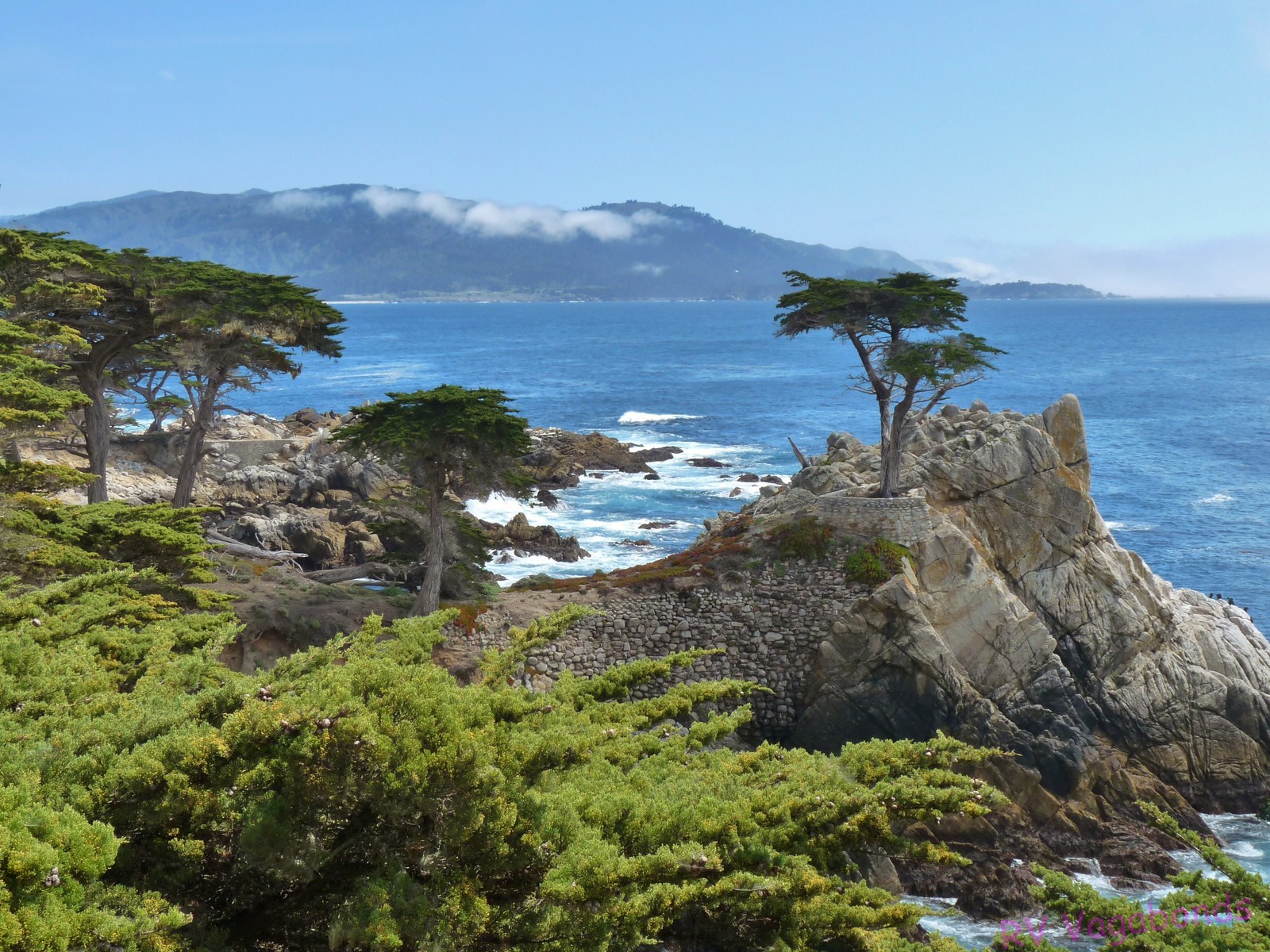
Jumping around, this is a shot taken at the Lone Cypress.  The colors of the Pacific reminded us of the waters around Hawaii.  After so many years of watching the rather murky waters of the Atlantic Ocean at Myrtle Beach the clean, clear waters here are impressive.
Denny and I stopped at Asilomar State Park to eat our picnic lunch and to wander the gravel beach looking for what we call beach glass but what the locals here call sea glass.  At this particular location the surf is so strong that the glass pieces we found were more like beads of glass--pretty but not of much use for making jewelry.  I'll hang onto them for now.
A little further down the road we stopped at Bird Rock to take photographs of the cormorants but I was distracted by these little guys.  Totally ignoring the "do not feed the wildlife" signs, they got a couple of kitty treats as rewards.
Some areas just cry out for that "artsy" shot.
And here in all its glory is the Lone Cypress; said to be over 250 years old and surviving the water and weather on this rocky outcropping.  Of course it now has a little help from man, being tethered to a rock wall.
I'm unsure whether this is part of the Links at Spanish Bay Golf Club or the Spyglass Hill Golf Club but whichever is it, the golfers here have a fabulous view of the ocean behind me.

Along 17 Mile Drive there is a Monterey cypress tree that has been shaped by the winds and named "the Ghost Tree".  Just a few yards down the road is a similar tree with a more fantastical shape that has no name but it is perfect for that touristy shot.
Again, sadly out of sync, this is the Pacific Grove Golf Course.  On one side the golfers have the Point Pinos lighthouse looking down upon them and on the other side they have the surf crashing up against the shoreline.  Beautiful.
Part of the famed Pebble Beach Golf Course, which non-registered guests may play for $495 plus the cost of the riding cart.  Registered guests pay the same green fee but get the riding cart thrown in.  Which explains why Denny and I did NOT try to reserve a tee time at Pebble Beach.
The Point Pinos lighthouse at Pacific Grove, California.
This is a very zoomed in shot of a seal that was hanging around a couple of guys who were out in the water on surf boards messing around.  I say messing around because they never tried to surf while Denny and I were watching.  The seal was having fun though.
The fog or marine layer moved in as Denny drove southward so when we arrived at Bird Rock which sits pretty far from the shoreline I wasn't able to get a clear photo of the many seals sitting on the right side of the rock along with the cormorants.  A little further down the road an entire section of the roadway had been fenced off as it is birthing and nursing seasons for the seals and the wildlife officers try to keep any and all people from disturbing the seals during the two month period the seals are here with their pups.
What we at first thought were dead trees and debris in the surf in front of Bird Rock turned out to be seals resting on their sides in the water with their flippers sticking out of the water.  A pair of high powered binoculars came in handy here and we passed them around to other folks standing nearby so they could enjoy a good look.
I could live here.  I couldn't afford it, but I could live here.
Many times during the day Denny and I pulled over to the side of the road and found a place to sit where we could just watch the action of the surf hitting the rocky shore.


The wind creates some strange tree sculptures in the area of Pescadero Point in Pebble Beach.
The standard tourist shot of the Lone Cypress.
The fog rolled in midway through our drive and I was afraid it would keep us from seeing the Lone Cypress and the other sights along 17 Mile Drive but the sun finally came out again.
Taken in the general area of the Lone Cypress on 17 Mile Drive.
We had thought about continuing down highway 101 to Big Sur but we had taken so long to drive through Pebble Beach that we simply headed for home.  Another time, perhaps....

Wednesday, September 07, 2011

Flash Floods, Food and Factories

Our week in photos:
We had to try a Whoopie Pie, made here in Lancaster, PA.

We drove through Bird-in-Hand, Blue Ball, stopped at Intercourse and didn't make it to Paradise--all here in Pennsylvania, of course.

Thanks to inattentive drivers, Amish horse and buggies are now equipped with flashing red lights and rear view mirrors.  And still people and  horses are killed when drivers in automobiles don't yield to them.

Our first stop was at the Intercourse Canning Factory.  There is a viewing area of the canning line and a large storefront where they sell salsas, jams, chow chow, saurkraut, pickled EVERYTHING and souvenirs.


The store was canning pickled eggs today.  I asked two different employees how many eggs they pickled in a day's work and neither one could tell me.  I guess they just worked there.


Next up and right across the street was the Intercourse Pretzel Factory.  There was no one actually making pretzels that day so one of the employees simply explained the process to us.  Then we were given the opportunity to make a pretzel by hand, as that's how it's done here.

You cross one end over the other and then cross it again.

Then you grab each end and fold them down to the other side and voila', you have a pretzel.
Of course, the pretzel makers here at the factory use the spin and twist-in-the-air method, which we all tried.  This is my dismal attempt.  It's definitely not as easy as it looks.

All that work made us hungry, so upon the advice of Don and Vicki, we headed to the Shady Maple Smorgasbord in East Earl, PA.  As did every other senior citizen in the county.
Denny really isn't in pain, despite his appearance.  And this is but a small segment of the several buffet lines that make up the vast eatery that is Shady Maple.
Last night we heard sirens which I thought were tornado sirens but there were no alerts on the weather radio so perhaps it was flood warnings because all the rivers and creeks here are reaching flood stage quickly.  I'm hoping we have no trouble getting out of here when we leave tomorrow for the state of Delaware. 

This is a beautiful area and in addition to eating a lot of fat food (there is also a small shoo-fly pie in our refrigerator) we have been gorging ourselves on the local peaches, green peppers, tomatoes, apples and sweet corn.  The farms here are lovely as is the countryside.  It is fun to drive the back roads looking at the farms and watching the hard working Amish and Mennonite families harvest their crops with their huge Belgians and big mules.  Farm stands offer fruit and vegetables unmanned, relying upon the honor system of payment.  It is a step back into the past here, and a most welcome one.  I could live here.
Enhanced by Zemanta
Related Posts Plugin for WordPress, Blogger...