Showing posts with label state parks. Show all posts

Monday, February 11, 2013

A Walk in the Park


 Denny and I are staying at a campground that's far from shopping, museums, golf courses, attractions, activities--well, pretty much everything.  We're here to visit with friends who are workamping for the season at this very quiet, very new campground that has little going for it other than a great view of the night sky and nice sized camp sites.  After two weeks here of a promised month long stay, the two of us just had to get out to do something so I picked a morning drive to Manatee Springs State Park, about 55 miles away.  The storms that had been predicted for the day were passing well north of us and I thought it was a good time to take advantage of a rare warm day.
A six dollar entry fee allows you access to several miles of biking/hiking trails as well as the opportunity to scuba dive.  The park is home to one of the largest fresh water springs in Florida; between 35 and 150 million gallons of water flow from the spring each day.  The water is crystal clear and there is a system of aquatic caves in the limestone below the water.


A handicap accessible boardwalk leads out to the Suwannee River where the manatees gather to feed.  Cypress trees and tall pines line the walkway from the beginning to the spring to the outlet at the Suwannee.  There's even an area roped off for swimmers for those brave enough for the cool, clear water--and the alligators that may lurk in the area.  Although today the only carnivorous types we found were the black vultures


Better eyes than ours spotted two young deer resting far back in the trees.  The older was well camouflaged with a coloring that was the same dull brown of the trees while this younger fawn was a richer brown and a bit easier to see, especially once he stood up to watch us all watching him.

But my primary reason for coming was to see the manatees.  And we did see a couple, but they were about 100 yards out from us in the wind-whipped waters which made them difficult to see.  When the sun came out and the wind slowed for a moment you could pick out their shape as they rose to the surface to breathe but once the water got rough again the manatees blended in as just a pale shape.


So I've cheated and included a couple of shots from our visit to the Homasassa Springs Wildlife State Park from a few years ago.  There the waters of the Homasassa River are shallower so I was able to get a better shot of these gentle creatures.  Click to enbiggen 'em, folks.


Below is a manatee rolling onto his side.  They seem to like to interact with humans, although this has a downside; many hundreds are gouged and maimed by boat propellers annually.


 Of course, part of our fun today was running into a young couple who are taking a year off from their everyday life and traveling by RV with their two young children.  The mother is homeschooling the kids, using their travels for the geology, history and geography lessons.  So Denny and I offered our suggestions of places they might like to see or the kids would enjoy (noticing a few eavesdroppers at the same time ;))  They were thrilled with the information and we were glad to be able to encourage their interest in the RV lifestyle.

This park does have a few water and electric campsites tucked away in the trees.  It's a beautifully quiet park this time of year and a nice place to spend a few hours to reflect, watch for manatees, swim, fish, hike or just sit and watch the aquatic plants wave in the clear spring water.

Just pick a day when the wind isn't blowing.  Sigh.


Tuesday, June 15, 2010

Scenic Byways

There was fresh snow on the mountain tops when we left Lander yesterday with a forecast of more rain and more flooding on Wednesday so it definitely was time to leave as flood waters still flowed over local fields and were tumbling close to bridges along our route.

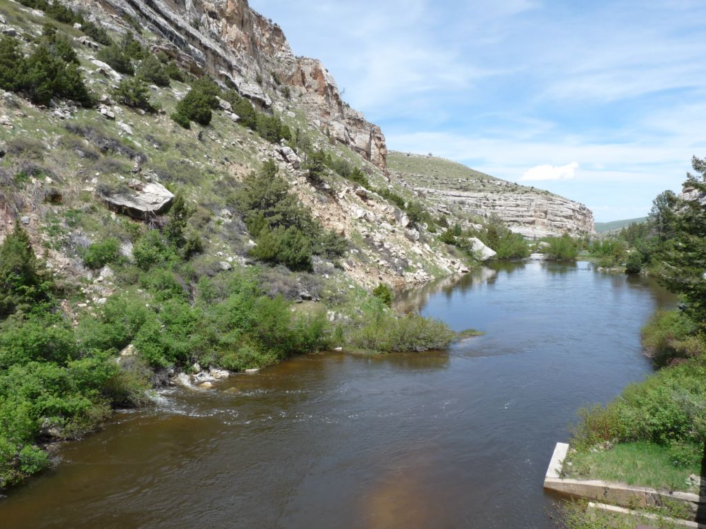
After checking our trucker's atlas to make sure there were no low tunnels/bridges I routed us along US 26 to US 20 to WY Hwy 120 up to Cody--all "red roads" which are those red lines on a map indicating a two-lane roadway as opposed to four lane interstates or highways.  US 20 was specifically indicated as a Wyoming scenic byway and indeed it is.  All of my photos were taken from inside the truck, so there are blurry bug splatters and interior reflections unfortunately.  But they should give you an idea of what we were seeing as we traveled through the Wind River Reservation and Wind River Canyon as we headed north towards Thermopolis (named for the hot springs in town).

Boysen Lake at Boysen State Park.


 Approaching the Wind River Canyon area.


 Wind River Canyon.


Wind River Canyon.


We were watching for big horn sheep when we saw these teepees by the river.  Much further down the road nearer to Meeteetse we saw a mule deer doe and her fawn.  The fawn was so tiny the prairie grasses were over his head and the only reason we saw him was because he was hopping over the grass in an attempt to keep up with his mother.


A split rock formation.


Leaving the Wind River Canyon and approaching Thermopolis the difference in the colors of the rock was striking.


There were few ranches in view on our 165 mile journey; this ranch called Monster Lake Ranch (and yes, there was a large lake farther down) was one of the most well kept that we saw.


Approaching Cody, the Absaroka Mountain Range, part of the Rockies, sprawls to the west of town.  Talk about some wide open spaces!


With scenery like this all along our route, the trip between Lander and Cody could have taken twice as long and we wouldn't have minded!

Thursday, June 10, 2010

The Sinks

About six miles from our campground is an oddity that we couldn't pass up; a river that disappears underground. Sinks Canyon State Park, located on Highway 131 south of Lander, Wyoming was created by glaciers eons ago which slowly etched away the soft limestone rock, creating an underground cavern into which the Po Po Agie River (pronounced Poh-Poh Szuh by some, there are several pronunciations) flows.

Normally, one hundred cubic feet of water per second flows down from the mountains into the cavern, called the Sinks, where the river totally disappears from view for a quarter of a mile, suddenly appearing on the other side of the park roadway seeping into a placid pool called The Rise that is filled with native (non-stocked) trout.  Gathering additional water from underground streams, the waters flow to the north end and suddenly gush out of the pool, once again forming a white water river.  Scientists have poured dye into the river, trying to figure out where the water goes when it funnels into the cavern, but the entrance is too narrow and filled with rock and driftwood to be able to explore it.  What they have found however, is that it takes the water two hours to surface a 1/4 mile downstream.  It is assumed that the flow of the water goes up and down through small crevices within the limestone before it finally surfaces again.

Of course, during our visit the water was not flowing at 100 cubic feet a second but instead at 500 cubic feet a second.  Which meant that there was too much water for the cavern so a large amount of water bypassed the cavern, flowing over land to continue downstream.  Therefore we did not get to experience the "sinking" of the river in its normal state.  Because it was not normal, but a raging, roaring monster of a river during this time of recent rains and heavy snow melt.  Still, we enjoyed learning about the phenomenon and wandering the tiny visitor's center of the park.

The arrow points to the entrance of the cavern, which normally sits much higher above the river in non-flood level stages.  Remember that clicking on any picture will enlarge it.

This area is where a woodland path leads you the 1/4 mile down river to the Rise.  Normally.

We were not interested enough in whatever information this plaque held to wade over to what was normally the path to the Rise, fearing a wild white water body surfing experience.

All of that roaring, rushing water comes out at the rise through small crevices into this placid pool.  The areas of white water is where the river is trickling out of the rock of the hillside.  Due to the increased amount of water coming out of the streams and hillside, the trout were hiding as this ruffled water was much more turbulent than what they are used to, stirring up a lot of mud.

At the end of this placid pool, the river once again turns to froth and white water as it makes its way out of the canyon.


On the way out of the park, we noticed rock climbers scaling the area of limestone and sandstone cliffs in the v-shaped crevice of the hillside.  They are circled in pink.
You don't see them?

Here they are!  Not bad for a point and shoot camera, huh?
Related Posts Plugin for WordPress, Blogger...