Showing posts with label wildlife. Show all posts

Saturday, July 14, 2012

Getting Partially Around Custer State Park

One of our favorite state parks is Custer State Park in South Dakota.  The last time we were here was the week of September 11 in the year of 2001 so that was a very weird and somewhat somber time to be visiting Mt. Rushmore and Custer SP so we thought we'd visit the park at a different time period.  I was surprised that the park wasn't more crowded with tourists, but then again, we were still suffering through 100+ degree heat here in South Dakota.

The visitor fee of $15 per vehicle might seem a bit steep until you realize that it allows you access to the park for a period of seven days; not bad.  This time around we entered from the eastern side of the park and headed south on the Wildlife Loop.  It wasn't long before we discovered one of several large herds of bison blocking traffic, so we settled in to take some photographs and a couple video clips.

This one makes you think of the buffalo nickel, doesn't it?  These guys are huge, weighing about a ton.  If you see a lone male buffalo, they are normally the older males who have fought for their herd of females and lost.  The older, losing male will then spend the rest of his days alone.
The bison have no fear of vehicles and simply amble across the roadway at will, assuming traffic will stop for them.  The truck pulled off near the center left of the photo below is a park ranger with a whip (I asked if it was to force the tourists to move along and got a grin from him).  I assume the whip was to assist in getting the bison to move if they blocked traffic for too long or created too much of a back up.
The wild donkeys are descended from animals that were once available for trail rides in the park.  When that business was closed, the donkeys were simply let go to live free in the park.  They are the park's beggars and will pretty much eat anything that's offered to them.
This little guy was not only adorable, but his coat was unbelievably soft.  He accepted pats and ear rubs but still preferred mom's milk to any treats being offered.  That's mom poking her head into the picture on the lower right.


Circling west and then north you arrive at Needles Highway.  There are three tunnels on this route, the smallest being 8'4" wide and 12' tall and the next smallest being 10' wide and only 10' tall.  It was at the 10' tall tunnel that we saw a Class C RV trying to figure out what they were going to do because they were too tall to enter and the roadway behind them (2 lane) was a long series of hairpin switchbacks.  I will say that when you enter the park you are given a booklet that has a map that lists all the interior roadway, all the tunnels and all the height and width limitations on said tunnels.  So no excuses for folks who get stuck.


 Needles Highway was named for the tall spires of rock jutting out of the ground in this section of the park.  It's quite a change from the rolling hills of the Wildlife Loop.

Can you see the resemblance to a bear in the yellowish rock below?
This time around we only saw bison and pronghorn antelope.  Our last time through we also saw big horn sheep, although there are also mountain goats, elk, and a couple of varieties of deer that live in the park.


Originally there were 50,000 forested acres in the park.  Wildfires have burned 23,000 of those acres, some of that thanks to the pine beetles that are killing the trees, turning them to tinder.  Trees that have been damaged by the pine beetles turn red/brown like those below and whole mountain sides are covered with these dying trees.


If you enlarge the photo above, you'll notice the kayakers.  This is Sylvan Lake, where there are boat rentals and a beach for swimming as well as hiking trails and picnic tables.  Another nice area for a picnic is by Legion Lake.  There are several campgrounds within the park, most of which have at least a few electric sites and fishing is permitted after you purchase a license.  Rock climbing is also permitted within the park and there are ranger talks and children's programs as well.
This bridge is actually located on Hwy 16 north of Custer State Park but is attractive because it's made of wood.  Somehow the huge beams were bent (I assume by soaking in water) and formed into these huge arches.  It's a lovely piece of work.
There is so much to see and do in the Rapid City area but I have to admit, I think I prefer the area after Labor Day when the crowds are a bit smaller.  I'm sure we'll be back to this area again.

Sunday, April 22, 2012

An Awesome Drive

One of the best things about full time rv travel is that by being on the road 12 months of the year you can arrive at busy tourist areas during the non-peak seasons.  Sometimes that means that you have to deal with bad weather or non-optimal conditions.  However on Thursday morning the overcast skies cleared around our campground so we decided to make the drive over to the Monterey and Pebble Beach area to follow the 17 Mile Drive and do some sightseeing.

Unfortunately Bl*gger refuses to cooperate when it comes to uploading photographs in the order I want them to upload unless I do them one at a time and I'm too impatient for that, so you have a mishmash here.  I'll simply add captions and let the photographs speak for themselves for the most part.

Monterey is a pretty little town but like many pretty little older towns that are now tourist areas the streets are narrow, the parking is limited and our big ol' truck is hard to maneuver so we didn't stop.  This display of carvings was right next to the intersection where we were stopped at a traffic signal.
The idea of Cannery Row appealed to me due to the John Steinbeck novel but of course now it's street after street of shops and the line to the Monterey Aquarium was all the way down the block so we kept driving.


Denny and I found a place to park Black Beauty along Lover's Point.  We offered a man who was out on the point a dollar to take our picture (kidding) and he said another man down the way had offered him five dollars so we compromised on two dollars and fifty cents.  We enjoy it when people play along with our silliness.  And of course we took a picture of him and his lady friends in return.
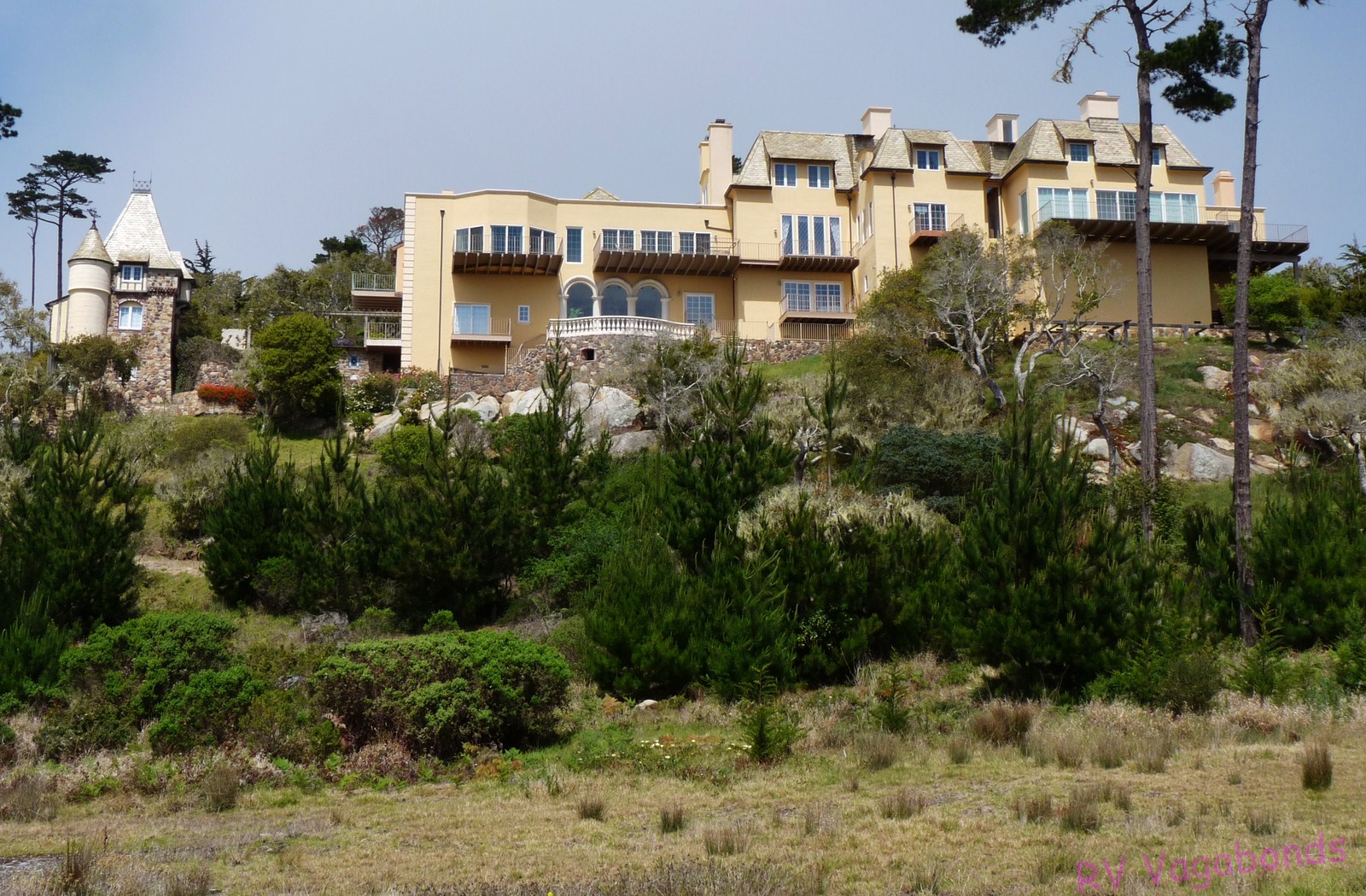
Out of order, this is the Chatillon Sur Mer, one of the hundreds of gorgeous residences (cottages a la the Hamptons?) along the 17 Mile Drive of Pebble Beach.  Since a standard four bedroom/3 bath one story home in Hollister, California which is 50 miles inland is selling for $549,000 how much do you suppose this baby would cost?
The view from Lover's Point in Pacific Grove, California.
Jumping around, this is a shot taken at the Lone Cypress.  The colors of the Pacific reminded us of the waters around Hawaii.  After so many years of watching the rather murky waters of the Atlantic Ocean at Myrtle Beach the clean, clear waters here are impressive.
Denny and I stopped at Asilomar State Park to eat our picnic lunch and to wander the gravel beach looking for what we call beach glass but what the locals here call sea glass.  At this particular location the surf is so strong that the glass pieces we found were more like beads of glass--pretty but not of much use for making jewelry.  I'll hang onto them for now.
A little further down the road we stopped at Bird Rock to take photographs of the cormorants but I was distracted by these little guys.  Totally ignoring the "do not feed the wildlife" signs, they got a couple of kitty treats as rewards.
Some areas just cry out for that "artsy" shot.
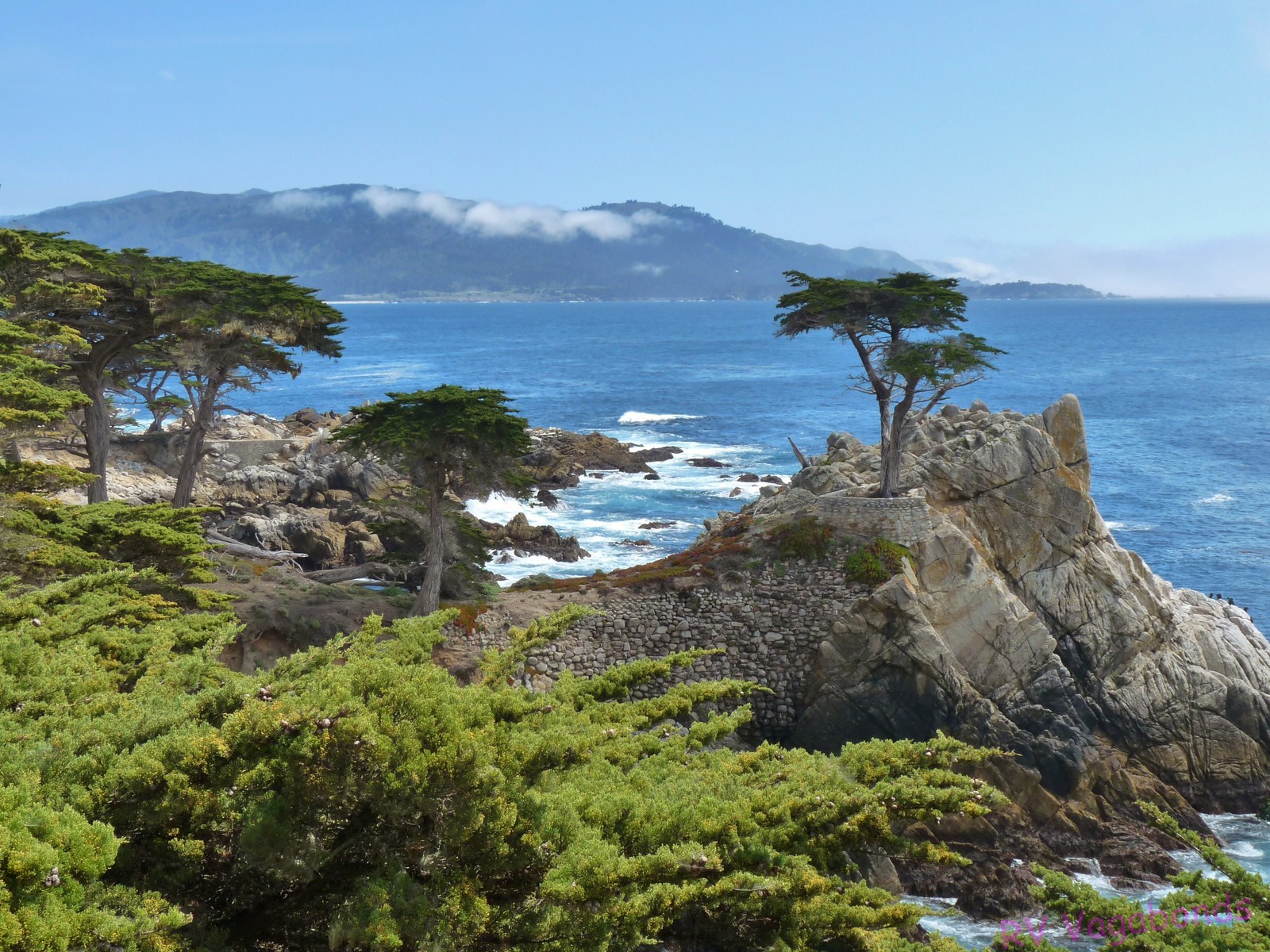
And here in all its glory is the Lone Cypress; said to be over 250 years old and surviving the water and weather on this rocky outcropping.  Of course it now has a little help from man, being tethered to a rock wall.
I'm unsure whether this is part of the Links at Spanish Bay Golf Club or the Spyglass Hill Golf Club but whichever is it, the golfers here have a fabulous view of the ocean behind me.

Along 17 Mile Drive there is a Monterey cypress tree that has been shaped by the winds and named "the Ghost Tree".  Just a few yards down the road is a similar tree with a more fantastical shape that has no name but it is perfect for that touristy shot.
Again, sadly out of sync, this is the Pacific Grove Golf Course.  On one side the golfers have the Point Pinos lighthouse looking down upon them and on the other side they have the surf crashing up against the shoreline.  Beautiful.
Part of the famed Pebble Beach Golf Course, which non-registered guests may play for $495 plus the cost of the riding cart.  Registered guests pay the same green fee but get the riding cart thrown in.  Which explains why Denny and I did NOT try to reserve a tee time at Pebble Beach.
The Point Pinos lighthouse at Pacific Grove, California.
This is a very zoomed in shot of a seal that was hanging around a couple of guys who were out in the water on surf boards messing around.  I say messing around because they never tried to surf while Denny and I were watching.  The seal was having fun though.
The fog or marine layer moved in as Denny drove southward so when we arrived at Bird Rock which sits pretty far from the shoreline I wasn't able to get a clear photo of the many seals sitting on the right side of the rock along with the cormorants.  A little further down the road an entire section of the roadway had been fenced off as it is birthing and nursing seasons for the seals and the wildlife officers try to keep any and all people from disturbing the seals during the two month period the seals are here with their pups.
What we at first thought were dead trees and debris in the surf in front of Bird Rock turned out to be seals resting on their sides in the water with their flippers sticking out of the water.  A pair of high powered binoculars came in handy here and we passed them around to other folks standing nearby so they could enjoy a good look.
I could live here.  I couldn't afford it, but I could live here.
Many times during the day Denny and I pulled over to the side of the road and found a place to sit where we could just watch the action of the surf hitting the rocky shore.


The wind creates some strange tree sculptures in the area of Pescadero Point in Pebble Beach.
The standard tourist shot of the Lone Cypress.
The fog rolled in midway through our drive and I was afraid it would keep us from seeing the Lone Cypress and the other sights along 17 Mile Drive but the sun finally came out again.
Taken in the general area of the Lone Cypress on 17 Mile Drive.
We had thought about continuing down highway 101 to Big Sur but we had taken so long to drive through Pebble Beach that we simply headed for home.  Another time, perhaps....

Monday, December 06, 2010

Random Photos

Another two weeks have flown by. Denny and I basically spent the time enjoying the sunshine although it wasn't always warm here. I'm getting some Christmas shopping and gift wrapping done and Denny has worked on some rig maintenance but it's been a leisurely kind of stay for us here. And now it's time to move on for a couple of weeks (rules of private membership campgrounds.)

Therefore this morning I'm posting some random photographs taken here in Florida.

Black vultures as lovebirds--who knew?
Pileated woodpecker.


Looking up into a live oak tree covered with Spanish moss.

A foot bridge at Bulow Plantation Campground.

Fishing boats at Darien, Georgia (just to see if you're paying attention when I said the pix were of Florida)
A Sandhill Crane wandering behind our fifth wheel.A medium sized gopher tortoise that can be found wandering the campground here in Clermont.We were located by the marsh area of the campground and so were treated to the sight of the Sandhill Cranes, Blue Herons and Great White Egrets.This week we were in the flight path of the Goodyear blimp as it left the NASCAR races at Homestead, Florida.

Enhanced by Zemanta
Related Posts Plugin for WordPress, Blogger...