Normally, one hundred cubic feet of water per second flows down from the mountains into the cavern, called the Sinks, where the river totally disappears from view for a quarter of a mile, suddenly appearing on the other side of the park roadway seeping into a placid pool called The Rise that is filled with native (non-stocked) trout. Gathering additional water from underground streams, the waters flow to the north end and suddenly gush out of the pool, once again forming a white water river. Scientists have poured dye into the river, trying to figure out where the water goes when it funnels into the cavern, but the entrance is too narrow and filled with rock and driftwood to be able to explore it. What they have found however, is that it takes the water two hours to surface a 1/4 mile downstream. It is assumed that the flow of the water goes up and down through small crevices within the limestone before it finally surfaces again.
Of course, during our visit the water was not flowing at 100 cubic feet a second but instead at 500 cubic feet a second. Which meant that there was too much water for the cavern so a large amount of water bypassed the cavern, flowing over land to continue downstream. Therefore we did not get to experience the "sinking" of the river in its normal state. Because it was not normal, but a raging, roaring monster of a river during this time of recent rains and heavy snow melt. Still, we enjoyed learning about the phenomenon and wandering the tiny visitor's center of the park.
The arrow points to the entrance of the cavern, which normally sits much higher above the river in non-flood level stages. Remember that clicking on any picture will enlarge it.

This area is where a woodland path leads you the 1/4 mile down river to the Rise. Normally.

We were not interested enough in whatever information this plaque held to wade over to what was normally the path to the Rise, fearing a wild white water body surfing experience.

All of that roaring, rushing water comes out at the rise through small crevices into this placid pool. The areas of white water is where the river is trickling out of the rock of the hillside. Due to the increased amount of water coming out of the streams and hillside, the trout were hiding as this ruffled water was much more turbulent than what they are used to, stirring up a lot of mud.

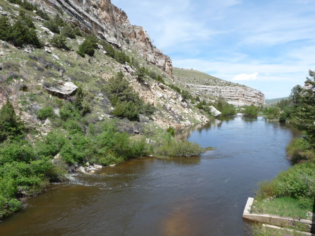
At the end of this placid pool, the river once again turns to froth and white water as it makes its way out of the canyon.
On the way out of the park, we noticed rock climbers scaling the area of limestone and sandstone cliffs in the v-shaped crevice of the hillside. They are circled in pink.
You don't see them?

Here they are! Not bad for a point and shoot camera, huh?

2 comments:
Wow that water looks like it means business.
Hey those folks are crazy. Just my opinion. Our daughter, who is also crazy used to love to rock climb, rapell (sp). She and her fiance of the time would go every weekend to some rock crag and climb and skin knees, elbows, faces, but they had fun...so said she. To each their own.
Countryside sure is pretty. Where to from there?
I'm afraid of heights, so I sure wouldn't be rock climbing. Very nice pictures, though.
Post a Comment